10 Largest Deserts In The World
Deserts are
called geographical areas where waterfall (rainfall and snowfall) is much less
than other areas. Often (mistakenly) sandy desert plains are called deserts
which is incorrect. It is another matter that the region with lowest rainfall
in India (Thar) is a sandy plain. It is not necessary for the desert to be
sandy. It is also not necessary to warm the desert. The Antarctic, which is a
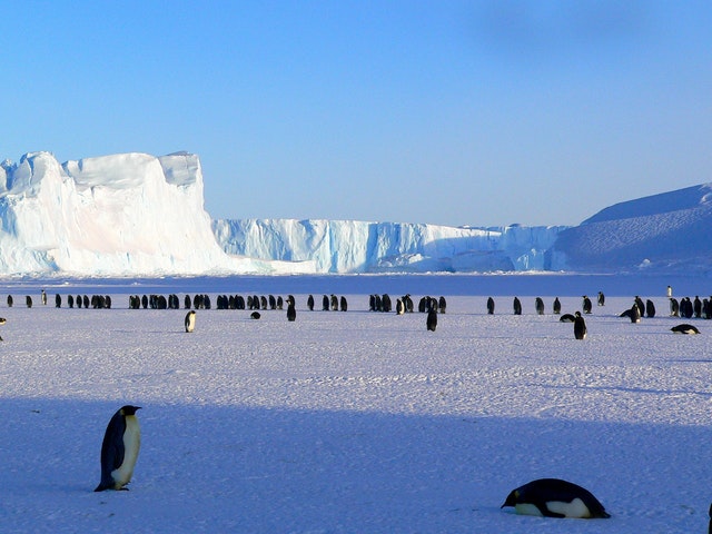
region covered with snow, is the largest desert in the world! There are many
deserts in other countries of the world which are not sandy. Today we will give
you information about some of the largest deserts or deserts in the world.
The largest desert in the world:
|
Rank |
Name |
Location and Country |
Type |
Area (km2) |
|
|
1. |
Antarctica |
Antarctica |
Cold Winter |
14000000
|
|
|
2. |
Arctic |
Arctic |
cold winter |
13985000 |
|
|
3. |
Sahara |
North Africa |
subtropical |
9000000 |
|
|
4. |
Arabic Desert |
Western Asia |
Subtropical |
2330000 |
|
|
5. |
Gobi Desert |
Central Asia (China
and Mongolia) |
Cold Winter |
1000000 |
|
|
6. |
Kalahari Desert |
Southern Africa |
subtropical |
900000 |
|
|
7. |
Great Victoria desert |
Australia |
subtropical |
647000 |
|
|
8. |
Patagonian Desert |
South America(Argentina and Chile) |
Cold Winter |
620000 |
|
Antarctica
Antarctica
(or Antartica) is the southernmost continent of the Earth, with the South Pole
embedded. It is located in the Antarctic region of the Southern Hemisphere and
almost entirely to the south of the Antarctic Circle. It is surrounded by the
southern ocean. With its 140 million square kilometers (5.4 million square
miles) area, it is the fifth largest continent on Earth, after Asia, Africa,
North America, and South America, with 98% of Antarctica covering an average of
1.6 kilometers of thick snow. Antarctica, on average, is the world's coldest,
driest and strongest winds continent and has the highest elevation of all
continents. Antarctica is considered a desert, as its annual precipitation is
only 200 mm (8 in), and it is also mostly in coastal areas. There is no
permanent resident here but around 1,000 to 5,000 people are present throughout
the year at various research centers which are spread all over the continent.
Only air-conditioned plants and organisms can survive here, including penguins,
seals, nematodes, tardigrades, fleas, various types of algae, and
microorganisms, as well as tundra vegetation, although there are many species
of terra australis (southern lands) throughout Europe. Various myths and
speculations were prevalent for centuries, but the credit for introducing the
whole world from this land in 1820 goes to Russian expeditioners Mikhail
Petrovich Lazarev and Fabian Gottlieb von Belsinghausen. The continent remained
largely neglected in the 19th century due to its heterogeneous climatic
conditions, lack of resources and isolation from the mainland. The first formal
use of the name Antarctica for the continent was in 1890 by the Scottish
cartographer John George Bartholomew. The name Antarctica comes from the Greek
compound word ανταρκτική Antarctica which is the feminine form of ανταρκτικός
Antarcticos and means "the opposite of the North". Twelve countries
signed the Antarctic Treaty in 1959, to date forty-six countries have signed
the treaty . The treaty supports scientific research with a prohibition of
military and mineral mining activities on the continent and is committed to
saving the continent's ecological zone. Currently more than 4,000 scientists
from many countries with different research objectives have various experiments
are doing.
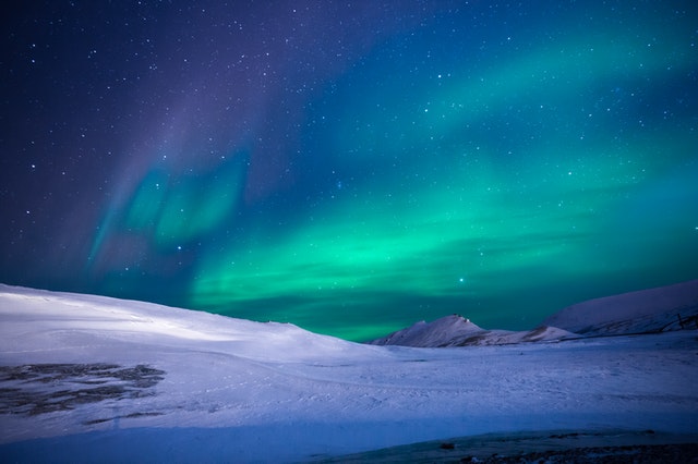
The arctic desert
The arctic
desert uplift is a terrestrial outcrop, covering the islands of Svalbard, Franz
Josef Land, Severni Island, and Severna Gemlia in the Arctic Ocean above 75
degrees north longitude. E hard snow environment covered with glaciers, snow
and bare rock.
SAHARA DESERT
The largest
hot desert in the world. The name Sahara is derived from the Arabic word for
desert, Sahara (صحراء) which means
desert. It stretches over a width of 1,300 kilometers north of Sudan and south
of the Atlas Mountains in the northern part of Africa from the Atlantic Ocean
to the Red Sea to a length of 5,600 kilometers. It also includes some coastal
areas of the Mediterranean Sea. It is almost equal to Europe in area and more
than twice the area of India. The desert is expanded in Mali, Morocco,
Muritania, Algeria, Tunisia, Libya, Niger, Chad, Sudan and Egypt countries. To
the south, it is bordered by the Sahal, a semi-arid tropical savanna region. It
separates the Sahara from the rest of Africa. Sahara is a low desert plateau
with an average elevation of 300 meters. The intermittent history of this
tropical desert is about 3 million years old. There are also some low volcanic
mountains in which Hogar of Algeria and Tibesti Mountains of Libya are the main
ones. The Eemi Kusi volcano situated on the Tibesti Mountains is the highest
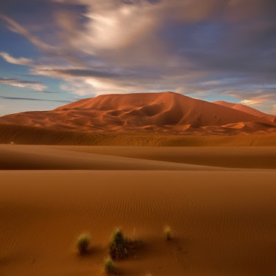
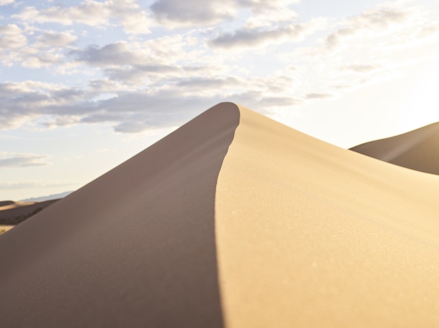
point of the Sahara with a height of 3,415 meters. The huge sand dunes and
ravines made with air make up its common geological nature. Large sand dunes
are found in the west of the Sahara Desert, especially in the Marcinia region.
The height of some sand dunes can reach 180 m (600 ft). Green deserts are found
somewhere in the Sahara desert due to the convenience of irrigation by a well,
river, or waterfall. Kufara, Tuyat, Wedelay, Tinnekuk, Eljuf are the main
desert gardens of the Sahara. Sometimes there are dry valleys of rivers called
Wadi. Saline water lakes are found here. The climate of Sahara Desert is dry
and contrasting. Here both daily temperature and annual temperature are high.
There is severe heat in the day and harsh winter at night. In the daytime the
temperature reaches 580 centigrade and at night the temperature drops below freezing
point. A recent new research has shown that the Sahara region of Africa was
transformed into the world's largest desert about two and a half thousand years
ago due to continuous greening. The northern regions of Africa were filled with
greenery 6000 years ago. Apart from this there were many lakes also. Most of
the evidence detailing this physical change has also been destroyed. These
studies were done on Lake Yoa located in Chad. According to the scientist
Stephen Kroplin here, it took a long time for Sahara to become a desert, while
according to the old theory and beliefs, about five and a half thousand years
ago, there was a rapid decrease in greenery and this desert was created. The
study of Dr.Peter Menocal from Columbia University in 2000 supports the old
belief. Harmattam winds from the northeast direction in the Sahara desert. They
are hot and dry. In the coastal areas of Guinea these winds are known as Doctor
Vayu, as they provide relief to the inhabitants of the region from the humid
weather. In addition, in the months of May and September, dusty thunderstorms
occur in the areas of North and Northeast Sudan here in the afternoon,
especially in the adjacent areas of the capital Khartoum. Due to them, it is
also very less visible. These winds named Habub bring heavy rain along with
lightning and thunderstorm.
ARABIAN DESERT
There is a
vast desert in western Asia that stretches from Yemen in the south to the
Persian Gulf in the north and from Oman in the east to Jordan and Iraq in the
west. Most of the Arabian Peninsula lies in this desert and the total area of
this desert is 23.3 lakh km2, that is, about 70% of the total area of
India. In the middle of it is the area named Rub al-Khali, which is the most
extensive sandy area in the world. The climate of Arabi Desert is very harsh.
There is extreme heat and sun outbreak during the day and at night the
temperature sometimes falls below zero. Due to this the fauna diversity is
quite low here, although there live animals like ghazals and oryx such as deer,
sand cat and prickly tail chameleon. Striped hyena, jackal and hyena were also
found here but they have become extinct here due to uncontrolled hunting and
other human activities. The earth forms of this region are diverse. Red sand
dunes, wide lava rocks, dry mountain ranges, dry plains and sandy areas that
sink like swamps are all present in this desert.
Gobi Desert
Gobi Desert
is located in China and Mongolia. It is one of the largest deserts in the
world. Gobi is one of the coldest deserts in the world, with temperatures
dropping to minus forty degrees. The Gobi Desert is spread over much of
Mongolia in the continent of Asia. This desert is one of the most desert in the
world. 'Gobi' is a Mongolian word meaning 'waterless place'. Nowadays the Gobi
desert is a desert, but in ancient times it was not so. The region was
inhabited by rich Indian settlements. The Gobi desert stretches from the
eastern hills of Pamir in the west to the Khingan ranges in the east and from
the Altai, Khangai and Yablonoi ranges in the north to the Altine and Nanshan
hills in the south. The western part of this desert is a part of the Tarim
Basin. It is the fifth largest in the world and the largest desert in Asia.
Like the Sahara Desert, this desert can also be divided into three parts- 1.
Takla Maken Desert 2. Alshan Desert 3. Muas or Ordis Desert Most of the Gobi
Desert is rocky rather than sandy. Here the climate of the desert changes
rapidly. Here, not only does the temperature change very quickly throughout the
year, but there is also a wide change in temperature within 24 hours. The
average rainfall in the Gobi Desert is 50 to 100 mm. is. Most of the rainfall
here is during the summer season. Most of the rivers in the desert flow during
the rainy season. Therefore, water remains in the river only during the rainy
season. Water currents from the nearby mountains merge into the dry land of the
desert. Plants called sacksol are found here in abundance in woody and drought
resistant properties. Almost leafless, this plant also grows in areas where the
sand is unstable. Due to its special properties, this plant helps in preventing
soil erosion. The Gobi Desert is believed to be the habitat for the 'Bakitorian
Camel', which has two humps. Donkeys of the Kachlu Jagnali variety are also found
here. Special bears of the desert of the world are found in this desert. The
species of these bears 'Majalai' or 'Gobi' has now reached the verge of
extinction. Apart from this, wild horses, squirrels and small-sized reindeer
are also found here. The Gobi Desert, one of the largest deserts of the world,
extending about 600 miles from north to south and about 1000 miles from east to
west, exists as a shallow trough between the Tibet and Altai ranges. Its
natural landscape is similar to that of the sloping plain, around which there
are mountainous heights. Due to erosion and corrosion activities, this desert
is famous for its distinctive peach. The high water marks on the foothills of
dried rivers and the banks of lakes are evidence of the change in climate here.
Civilization relics suggestive ruins of various civilizations are also found in
this desert. The heat here is very high and strong and the average temperature
in summer is 45 ° to 65 ° C. And the temperature of winter is 15 ° C. Stays
till. Sometimes snow storms and hot sand mixed storms also come here. Here,
grass and prickly shrubs are mainly found in vegetation. There is often a lack
of water here. The wells are found on caravan routes from 10 miles to 40 miles.
Troubled by the dust of the Gobi desert, China has built a wall of trees
through plantations from the outskirts of the capital Beijing to Mongolia. Due
to this, China has got rid of this dust storm known as 'Yellow Dragon'. China
plans to halt this desert, because it fears that its expansion could create a
crisis for its agricultural system. Due to falling groundwater levels,
indiscriminate cutting of forests and grazing of livestock, this desert
continues to spread.
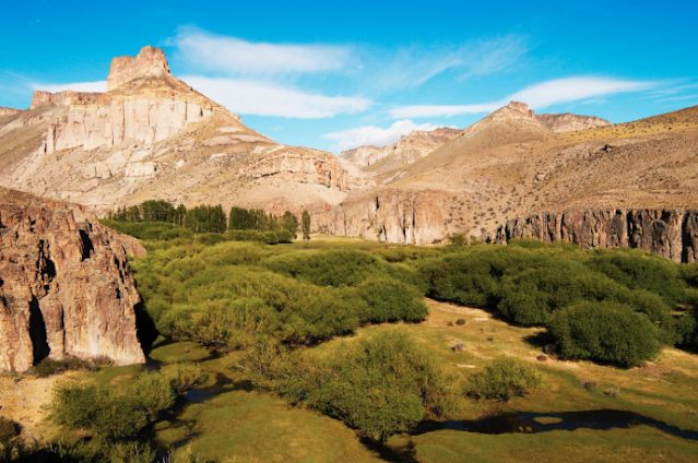
The Patagonian Desert
The
Patagonian Desert, also known as the Patagonian Steppi, is the largest desert
in Argentina and the 8th largest desert in the world by area, covering an area
of 673,000 square kilometers.
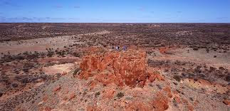
Great Victoria
Great
Victoria is one of the largest deserts in the world, in Australia.
Kalahari Desert
Kalahari is
a vast desert in the world. The area of the Kalahari Desert is about 9
million sq km in the border of Botswana, Namibia and South Africa countries of
South Africa. The Kalahari Valley covering it is spread over some 2.5 million
square kilometers. The desert receives 8–19 cm of rainfall annually. Some parts
of it receive rain for three months in a year, due to which the population of
animals is also seen here. The tribes living here are called Bushmen. There
were several measures for wildlife conservation in the 1980s. It is a tropical
desert. To the west of it is the Namib Desert. Kalahari also has two large salt
marshes. To its northwest is the Okavango River Delta which is rich in
wildlife. The sand found in this desert also varies from place to place. Some
people do not consider Kalahari as a desert, because the level of rainfall here
is quite good. During winter, the temperature here goes below the freezing
point. Various species of fauna and flora are found in this desert. This desert
is very famous for its minerals, it has ample reserves of diamond, nickel and
uranium etc. It is the 'Orange River in the south and the Zambezi River in the
north. The word 'Kalahari' is possibly derived from 'kir', which means 'very
thirsty'. It is also said that Kalahari is a special tribal word, originating
from 'Kalagari' or 'Kalagare', which means 'waterless place'. Like other
deserts, this place also has flat areas of sand dunes and gravels. The mounds
here are almost constant.
The Syrian Desert
The Syrian
Desert (Syrian Desert, Arabic: بادية الشام, Badiyat
As-Sham) is an expanse of grassland and desert spread over 500,000 sq km
located in the Middle East. It is spread over southeast Syria, northeastern
Jordan, northern Saudi Arabia and western Iraq. In the south it can be found by
going through the Arabic desert. Most of its area is a dry pebble-gravel ground
where there are mounds.
The Great Basin Desert
The Great
Basin Desert is part of the Great Basin between the Sierra Nevada and the
Wasatch Range.



ConversionConversion EmoticonEmoticon